

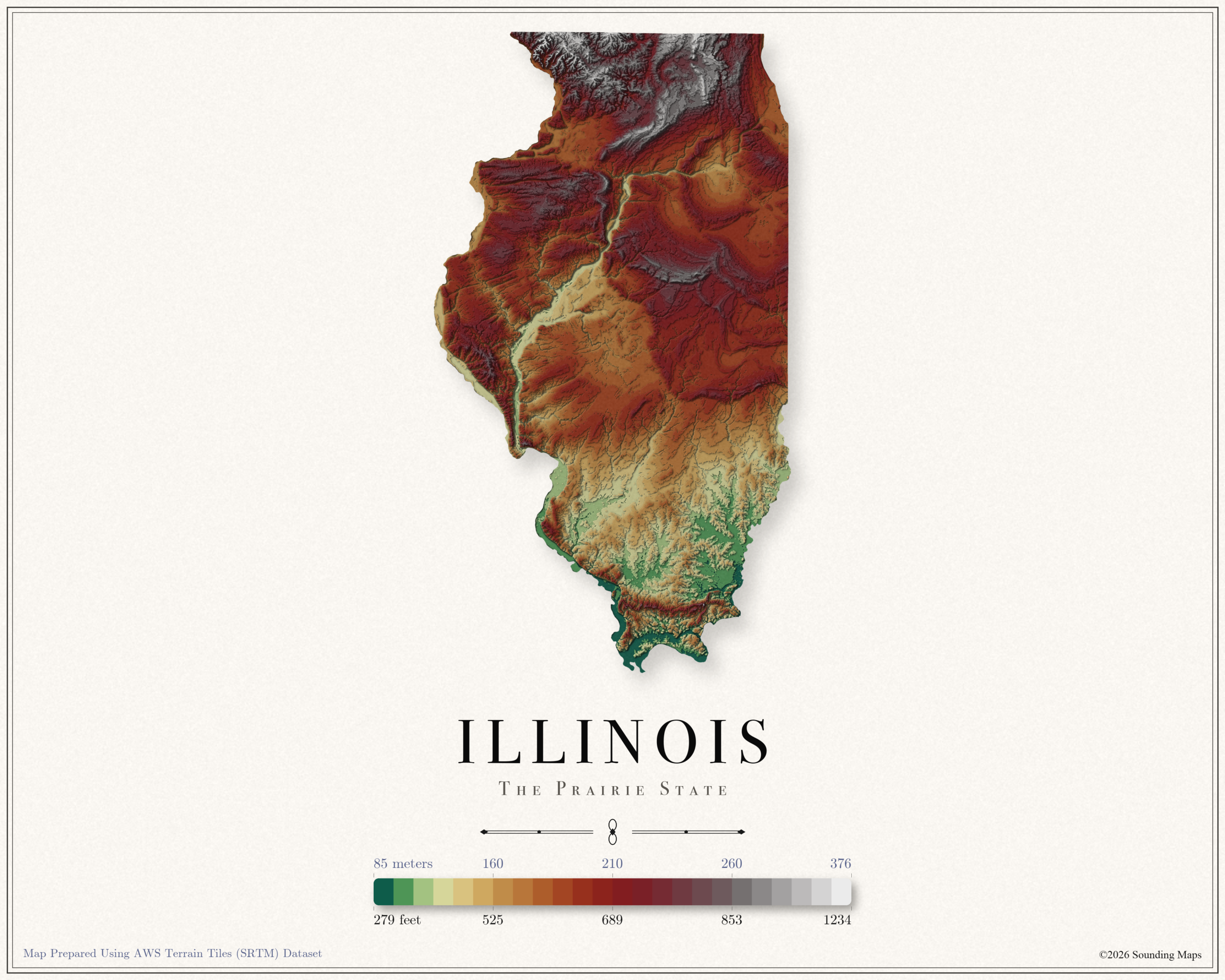
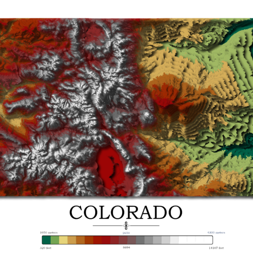
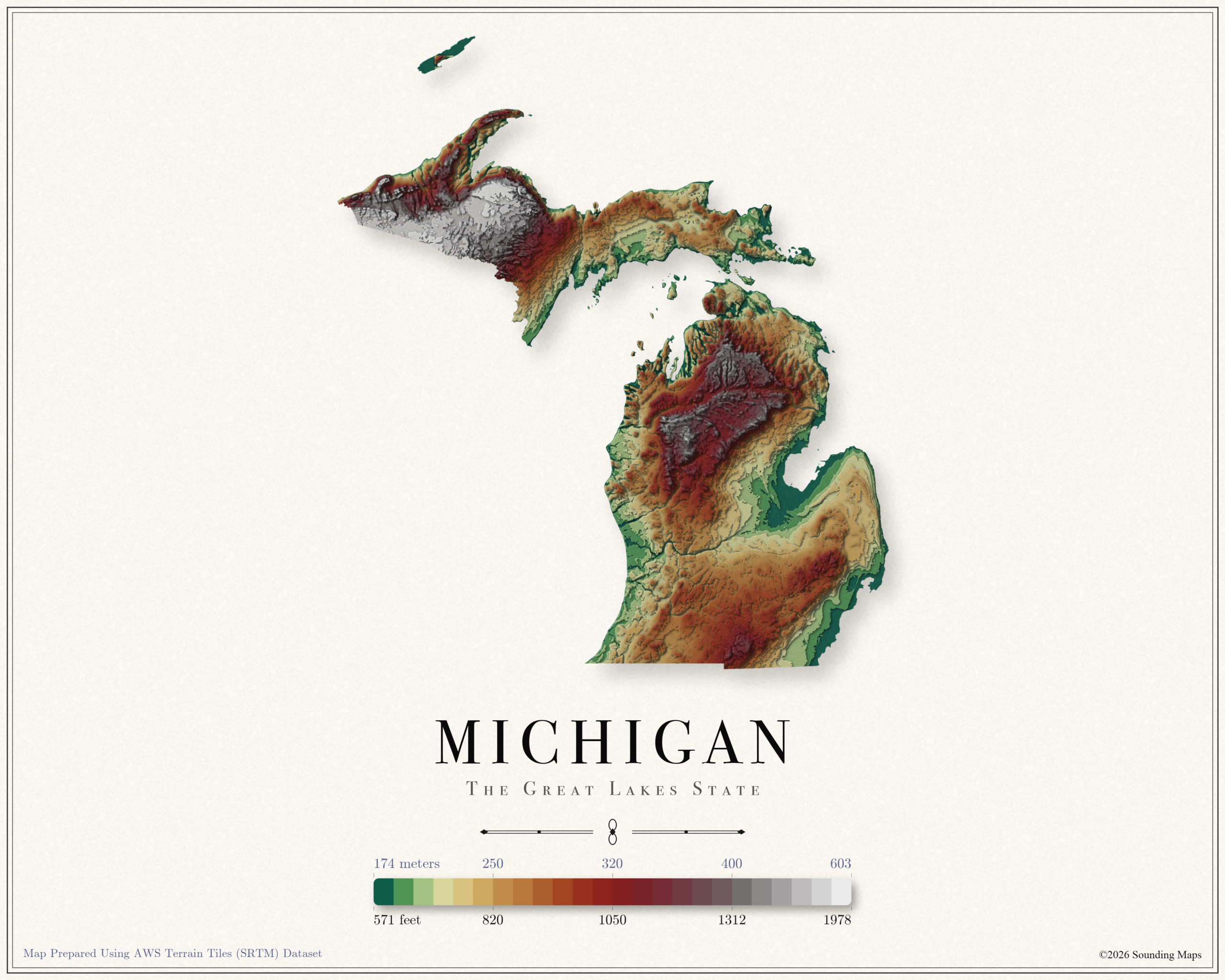
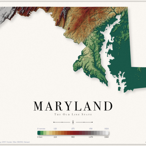
Contour Elevation Map of New York State
In this New York topographic elevation map, each contour represents a change of 100 meters or 328 feet.
From the map, it’s easy to identify where interstate 90 (I90) runs. Beginning in Albany, I90 stretches across low elevation through Rochester, Syracuse, Rome, Utica, and Albany.
Highest Point in New York
Mount Marcy, located in the heart of the Adirondacks, at an elevation of 1610 m / 5282 ft. is the highest point in New York State.
Lowest Point in New York
The lowest point of New York is sea level at 0 m / 0 ft which surrounds Long Island.
New York Map Datasets
The data was prepared with QGIS and data provided by Open Topography. OpenTopography facilitates community access to high-resolution, Earth science-oriented, topography data, and related tools and resources.