
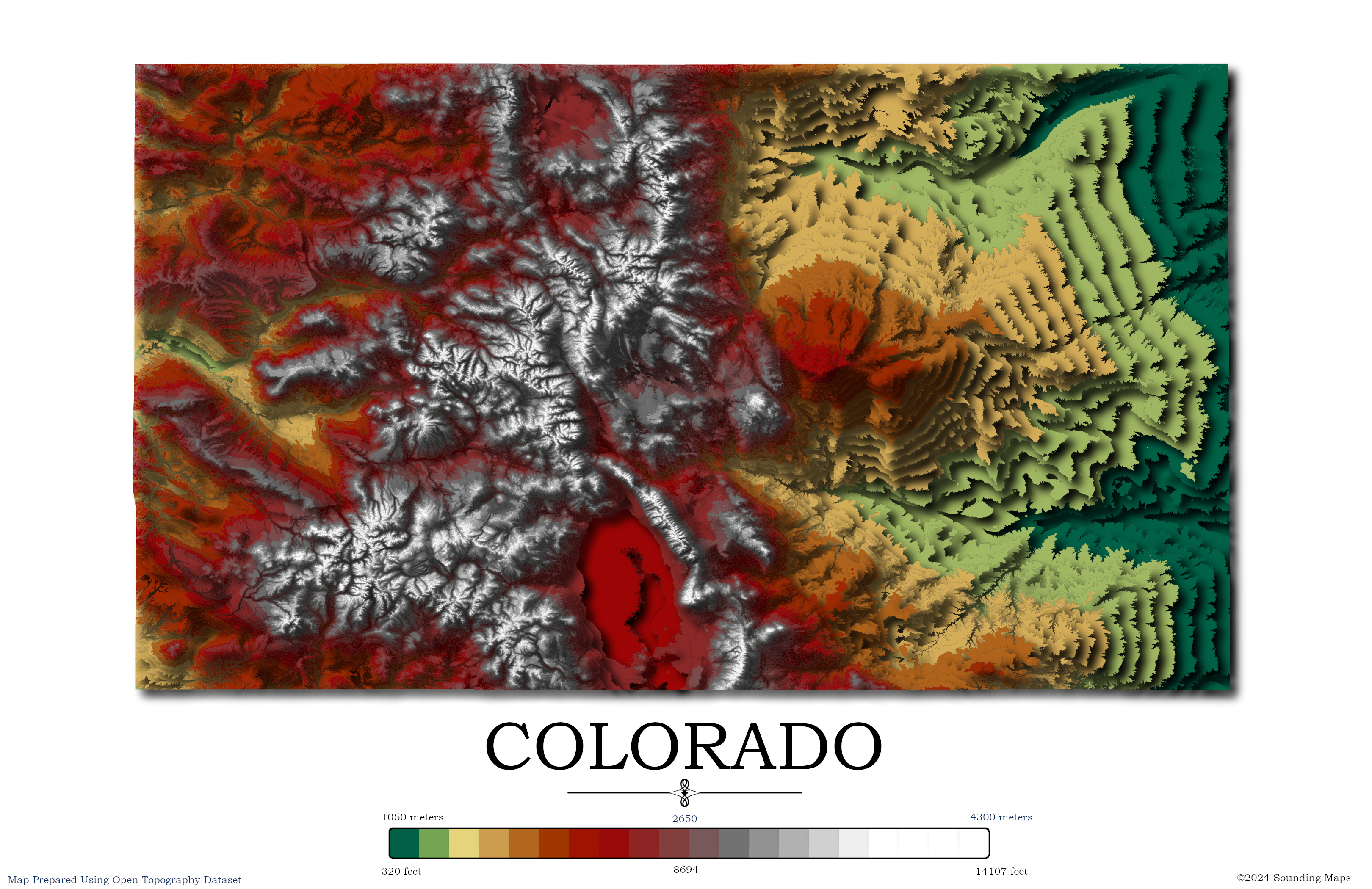
Contour Elevation Map of Colorado
Each contour in this Colorado topographic elevation map represents a change of 50 meters or approximately 164 feet.
Colorado is notable for its diverse geography, which includes high plains to the east, alpine mountains to the west, and deserts with massive sand dunes and deep canyons.
The drive from the east to Denver, either on Interstate 76 or 70, surrounds you with rolling, flat land leading up to a massive mountain range hovering over Denver.
Roughly 70% of Colorado’s population resides along this mountain range on the Eastern edge of the Rocky Mountains.
Highest Point in Colorado
Mount Elbert is the highest summit of the Rocky Mountains of North America and the highest point in the Colorado. The summit of Mount Elbert is at 14,440 feet (4,402.1 m).
Lowest Point in Colorado
The point where the Arikaree River flows out of Yuma Country, Colorado, and into Cheyenne Country, Kansas, is the lowest in Colorado at 3,317 feet (1,011 m) elevation. This point is the highest low elevation point in any state.
Colorado Map Datasets
The data was prepared with QGIS and data provided by Open Topography. OpenTopography facilitates community access to high-resolution, Earth science-oriented, topography data, and related tools and resources.
