
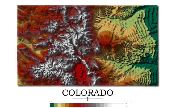
Contour Elevation Map of Colorado Each contour in this Colorado topographic elevation map represents a change of 50 meters or approximately 164 feet. Colorado is notable for its diverse geography, which includes high plains to the east, alpine mountains to the west, and deserts with massive sand dunes and deep […]
Elevation Maps
3 posts
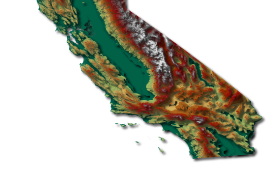
Contour Elevation Map of California In this California topographic elevation map, each contour represents a change of 100 meters or 328 feet. California is the third largest state in the Unites States after Texas and Alaska. It has an area of 164,696 square miles (423,970 km2). Coincidentally, California is home […]

Contour Elevation Map of New York State In this New York topographic elevation map, each contour represents a change of 100 meters or 328 feet. From the map, it’s easy to identify where interstate 90 (I90) runs. Beginning in Albany, I90 stretches across low elevation through Rochester, Syracuse, Rome, Utica, […]