
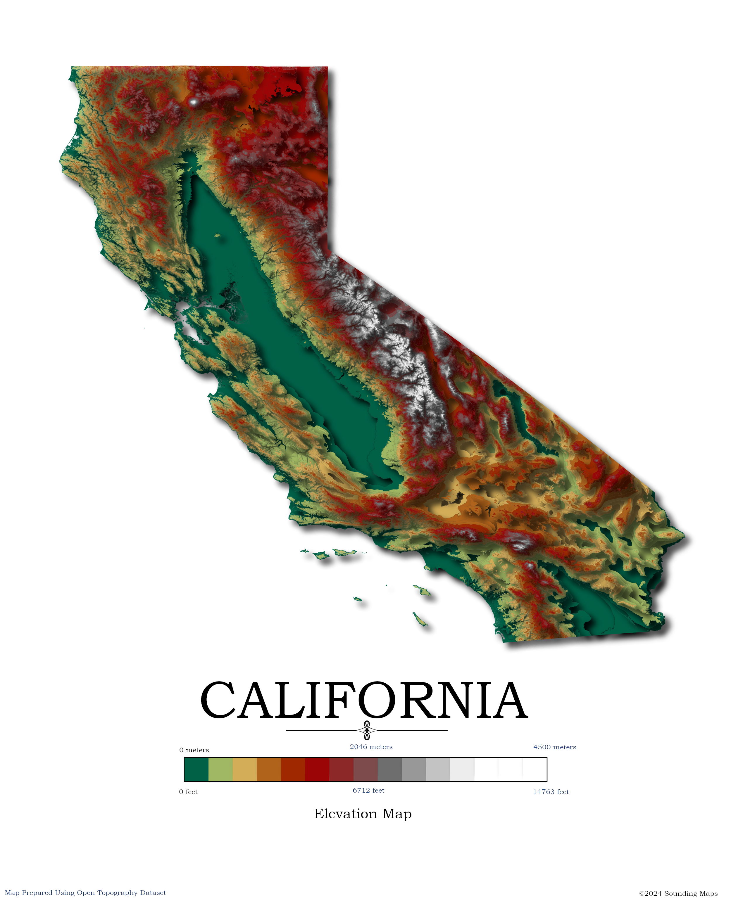
Contour Elevation Map of California
In this California topographic elevation map, each contour represents a change of 100 meters or 328 feet.
California is the third largest state in the Unites States after Texas and Alaska. It has an area of 164,696 square miles (423,970 km2). Coincidentally, California is home to both the highest and lowest elevation points in the contiguous United States.
Highest Point in California
Mount Whitney, located about 150 miles north of Los Angeles, at an elevation 14,505 ft. (4421m), is the highest elevation point in California and the contiguous United States.
Lowest Point in California
The lowest point of California and the United States is at Badwater Basin, located in Death Valley National Park. It has an elevation of 282 ft. (86 m) below sea level.
California Map Datasets
The data was prepared with QGIS and data provided by Open Topography. OpenTopography facilitates community access to high-resolution, Earth science-oriented, topography data, and related tools and resources.
