
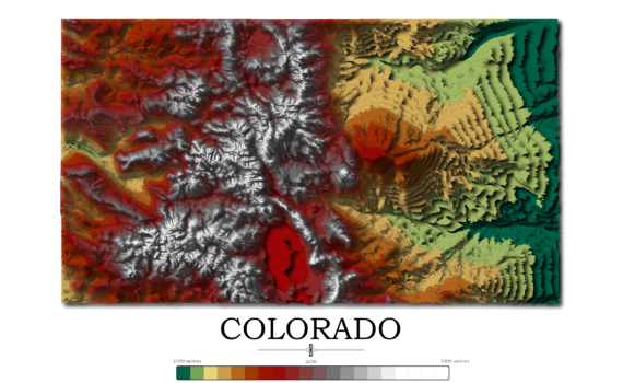
Contour Elevation Map of Colorado Each contour in this Colorado topographic elevation map represents a change of 50 meters or approximately 164 feet. Colorado is notable for its diverse geography, which includes high plains to the east, alpine mountains to the west, and deserts with massive sand dunes and deep […]
Yearly Archives: 2024
3 posts
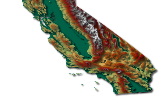
Contour Elevation Map of California In this California topographic elevation map, each contour represents a change of 100 meters or 328 feet. California is the third largest state in the Unites States after Texas and Alaska. It has an area of 164,696 square miles (423,970 km2). Coincidentally, California is home […]
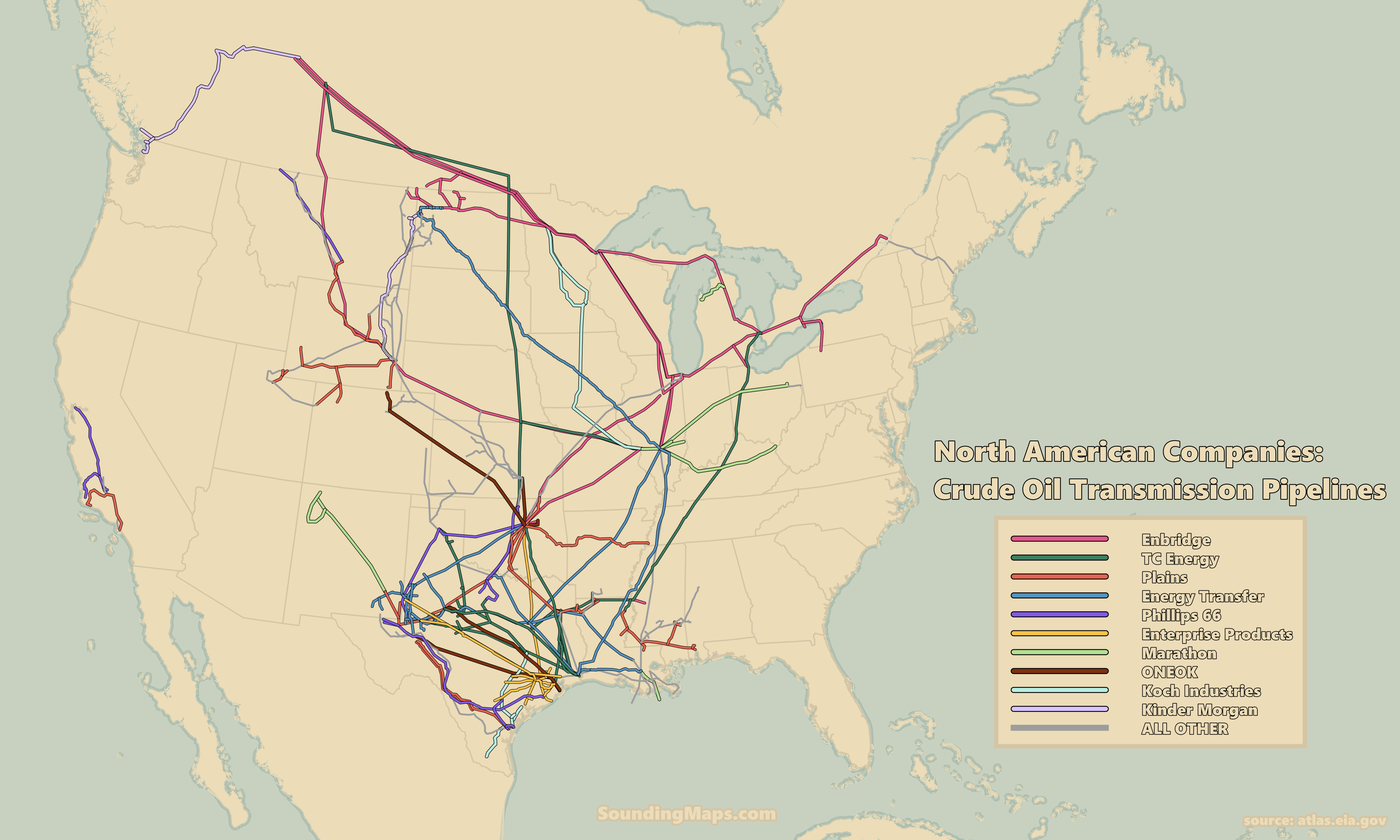
This map visualizes the ten significant companies’ dominance of crude oil transmission pipeline infrastructure throughout the United States and Canada. Selected by pipeline length, it is a map of the United States and Canada’s major crude oil pipeline networks. Ten North America crude oil companies dominate the energy transmission network. […]